Have you ever heard of the island of Bermeja? Once marked on maps and recognized as a legitimate territory, this little piece of land in the Gulf of Mexico has now vanished without a trace. What happened to the island of Bermeja? How could something so prominent on a map yesterday suddenly disappear today? It’s a mystery that has puzzled many and sparked numerous conspiracy theories.
Some believe that the United States government intentionally destroyed the island to gain control over oil reserves in the area. Others speculate that the island never existed in the first place, and its appearance on maps was nothing but a mistake. Whatever the truth may be, the story of the island of Bermeja is a fascinating one that reminds us how even the most solid and tangible things can disappear without warning.
A map of the sailors from Portugal
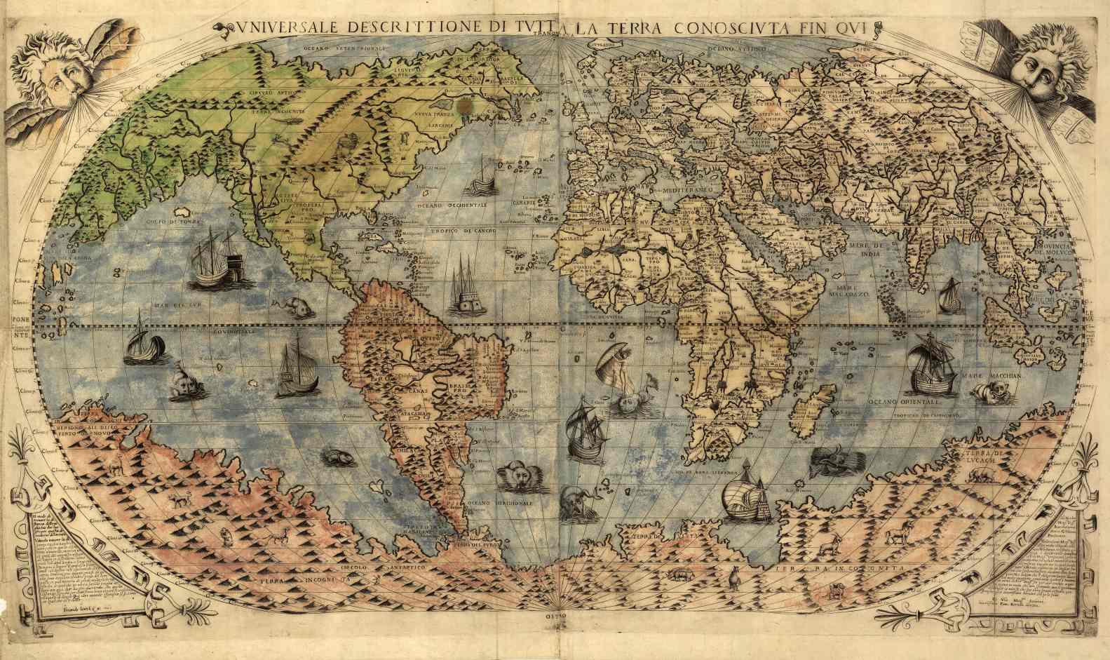
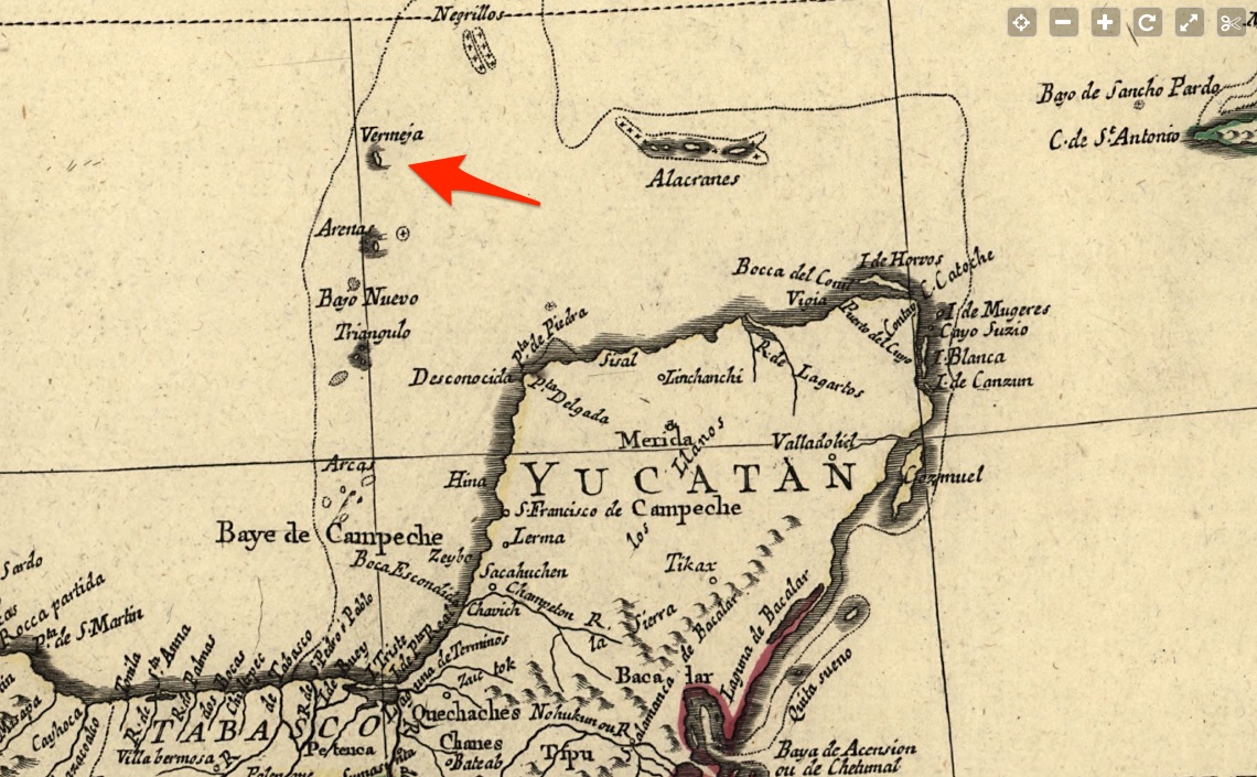
First, Portuguese sailors found this island, which was said to be 80 square kilometers in size. According to a number of historical accounts, Bermeja was already there on a Portuguese map from 1535, which is kept in the State archive of Florence. It was a report that Alonso de Santa Cruz, a Spanish cartographer, mapmaker, instrument maker, historian and teacher, presented before the court in Madrid in 1539. There it’s called “Yucatan and the Islands Nearby.”
In his 1540 book Espejo de navegantes (Mirror of Navigation), the Spanish sailor Alonso de Chavez also cited about the island of Bermeja. He wrote that from a distance, the small island looks “blondish or reddish” (in Spanish: bermeja).
On Sebastian Cabot’s map, which was printed in Antwerp in 1544, there is also an island called Bermeja. On his map, besides Bermeja, the islands of Triangle, Arena, Negrillo and Arrecife are shown; and the Bermeja island even has a restaurant. Bermeja’s image stayed the same during the seventeenth century or most of the eighteenth century. In line with old maps of Mexico, cartographers in the 20th century put the Bermeja at that particular address.
But in 1997, something went wrong. The Spanish research ship didn’t find any sign of the island. Then the National University of Mexico became interested in the loss of the island of Bermeja. In 2009, another research ship went to find the lost island. Unfortunately, scientists never found the Bermeja island or any traces of it.
Others are also missing
Bermeja wasn’t the only island that suddenly disappeared, of course. Between New Caledonia and Australia, in the coral sea, an island named Sandy had the same fate. But the island was really sandy and looked like a long spit of sand that wasn’t marked on all the maps. However, almost all old maps showed it, and it is thought that the famous explorer Captain James Cook was the first person to notice and describe it in 1774.
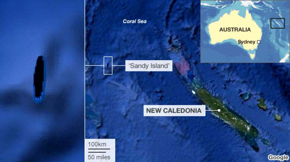
About a century later, an English whaling ship had been to the island. In 1908, it gave the British Admiralty exact geographical coordinates in its report to them. Because the island was small and had no people, not many were interested in it. Eventually, its shape changed from map to map.
In 2012, Australian marine geoscientists and oceanographers went to the sandy island. And the fact that they couldn’t find the island was a disappointing surprise to their curiosity. Instead of an island, there were 1400 meters of deep water below the boat. After that, the scientists wondered if the island could vanish without a trace or never have been there. It quickly became evident that it didn’t exist a few decades ago.
In 1979, French hydrographers took the Sandy island off their maps, and in 1985, Australian scientists did the same. So the island was only left on digital maps, which people usually think of as paper. The island itself was no longer there. Or it could have only been real in the minds of those who witnessed it first hand.
And there was an island called Haboro near Hiroshima, off the coast of Japan. For example, 120 meters long and almost 22 meters tall isn’t very big, but it’s still easy to notice. On the island, the fishermen got off, and tourists took it away. The pictures from 50 years ago look like two rocky peaks, one covered in plants.
But eight years ago, almost all of the island went underwater, leaving only a small rock. If no one knows what happened to Sandy, the reason why the island disappeared is clear: it was eaten by the tiny marine crustaceans called isopods. They lay their eggs in rock cracks and destroy the stone that makes up islands yearly.
Haboro melted away until it was just a small pile of rocks. Crustaceans are not the only creatures that live in the ocean and eat the islands. Many coral islets are killed by other creatures in the ocean, like the crown-of-thorns starfish. Off the coast of Australia, where these sea stars are very common, many coral reefs and small islands died.
Is this what happened to Burmeja Island?
The same thing could happen to Bermeja as to Sandy. The first people who saw the Bermeja said it was bright red and on an island, so it might have come from a volcano. And this kind of island is easy to make and easy to destroy.
The Bermeja had enough food, but there are no research ships that found any sign of the island. There are no rocks left, no broken stones, nothing; only the deepest part of the ocean. Bermeja has yet to go away or be lost. Researchers say with a lot of confidence that it never existed. As you know, it’s the same thing when we talk about the island of Sandy. In the 18th century, a cartographer of New Spain thought this because nothing else was shown on the map to the north of an island Arena.
The researcher Ciriaco Ceballos, conducting cartographic surveys, have not found Bermeja or Not-Grillo. He gave a simple explanation for why the mapmakers before him had made mistakes. Due to the numerous reefs in the Gulf, the water was rough, and voyage was very dangerous, particularly on the boats of the 16th century.
It’s not strange that the sailors attempted to stay out of the deep water and weren’t hurrying to check out the island. And it’s so easy to be wrong in the testimonies and observations. But this point of view was thrown out and forgotten when Mexico got its independence.
The cards with pictures of Bermeja were used to start making maps of the Gulf. And there has never been a test to see whether islands and nobody are there. But there is more to the story than just the obvious explanation. Its main point is that Bermeja is one of the points that make up the sea border between Mexico and the United States.
In this variant, the Americans were not profitable to Bermeja because oil and gas pastures in the Gulf of Mexico would belong to the United States, not Mexico. And it is said that the Americans did take the island, which shouldn’t exist because they just blew it up.

